See Every Span.
Every Mile.
Smarter.
Real-time corridor intelligence powered by drones, AI, and geospatial visualization. Make confident decisions backed by complete data.
Why CorridorTwin
The Problem
Utilities spend $8B+ annually on vegetation management. Poor road conditions contribute to thousands of deaths each year. Traditional inspections—helicopter flyovers, manual surveys, pavement sampling—are costly, episodic, and incomplete. You're making critical decisions with incomplete data.
The Solution
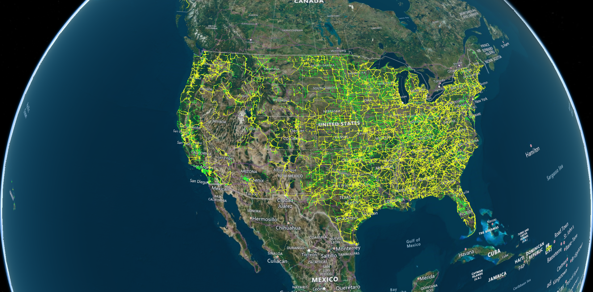
CorridorTwin delivers continuous, span-level intelligence using drones, AI, and geospatial visualization. Capture what you need, analyze it instantly, visualize it beautifully. Make confident decisions backed by complete corridor data, not partial snapshots.
FEATURE SHOWCASE
See It In Action
Story Mode - Project Sharing
View video →
LiDAR Point Cloud Analysis
View video →
Point Cloud Classification
View video →
Core Capabilities
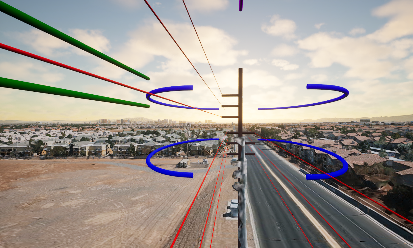
Span-Level Vegetation Monitoring
Real-time drone-based vegetation clearance monitoring with AI-powered analysis. Detect overgrowth before it becomes a liability.
- •Predictive maintenance
- •Wildfire risk reduction
- •NERC FAC-003 compliance

Road Condition Assessment
Comprehensive pavement analysis and deterioration mapping. Prioritize maintenance spending where it matters most.
- •Reduced inspection costs
- •Safety improvement
- •Asset optimization
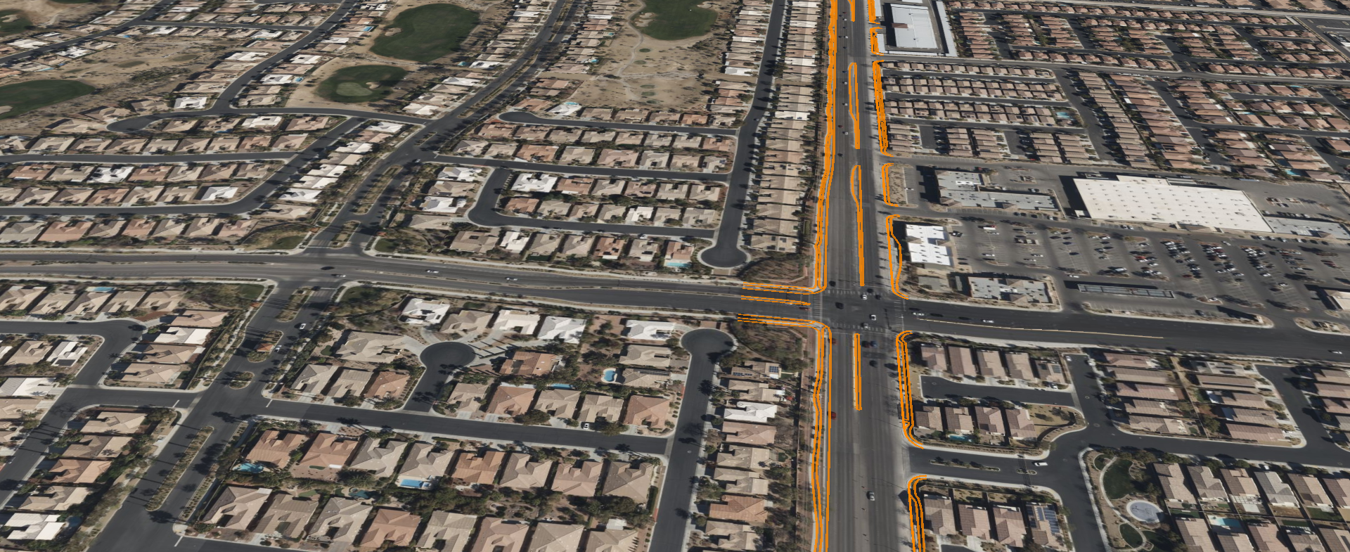
Advanced 3D Corridor Models
Create immersive 3D digital twins of your corridors with real-time data integration. Visualize complex infrastructure and terrain in interactive 3D space.
- •Better decision-making through spatial understanding
- •Immersive stakeholder presentations
- •Detailed asset inventory
HOW IT WORKS
From Capture to Intelligence
Capture
Drones, vehicle sensors, satellites
Process
Cloud photogrammetry & LiDAR pipelines
Analyze
AI detects risks, distresses, and growth
Visualize
Corridor twins in CesiumJS & Unreal Engine
Real-time data collection from multiple sources using advanced drone technology and sensor networks.
WHY AERO
Built for the Real World
Proven Expertise
Years of experience combining drone technology, AI algorithms, and digital twin visualization to solve real infrastructure challenges.
Advanced Technology Stack
Built on Unreal Engine 5 and Cesium for stunning 3D visualization and real-time rendering capabilities.
Enterprise Integrations
Seamlessly integrates with Bentley iTwin, PLS-CADD, and existing DOT asset management systems.
Open Standards
Export data to GeoJSON, CAD (DWG/DXF), and 3D Tiles formats for compatibility with any system.
"CorridorTwin gives us real-time insights we never had before — and helps us prioritize dollars where they matter most."
Infrastructure Director
Major US Utility
COMPLIANCE & PARTNERS
Industry Standards & Trusted Partners
Industry Compliance
- NERC FAC-003 vegetation management standards
- FHWA PM2 performance metrics compliance
- DOT asset management integration
Technology Partners
Cesium
3D Geospatial Platform
Bentley Systems
Infrastructure Engineering Software

Amazon Web Services
Cloud Computing Platform
© 2025 AERO AI. All rights reserved.
← Back to AERO AI Homepage